Maps & Guides
Ready to explore? Don’t forget your map!


Mobile Map
Use our interactive mobile map to find your way to your favorite exhibits and follow the one-way paths throughout the museum. Find restrooms, hand sanitizing stations, eating areas, accessible features, and more.
Print Map
Print maps are available at all entrances and at the Visitor Services desk in Stanley Field Hall.
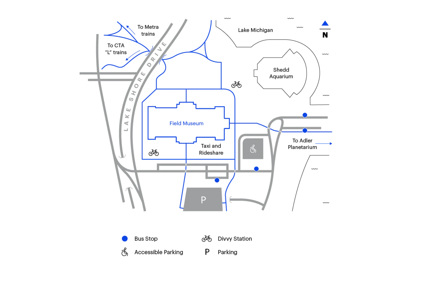
Museum Campus Map
Need help finding your way around our corner of the Museum Campus? The Museum Campus Map highlights parking areas, CTA bus stops, and pedestrian paths to CTA trains.
Tactile and Auditory Guide
Explore the Museum with touch, sound, and smell! We have an Auditory and Tactile guide available in our Visitor Center on the ground level of the Museum to showcase exhibits accessible with a variety of senses.


Carl Cotton Map
Celebrate one of Chicago’s unsung historical heroes: Carl Cotton. Cotton was a taxidermist, artist, and exhibition preparator who worked at the Field Museum from 1947 until his death in 1971. He is the Field Museum’s, and possibly Chicago’s, first professional African American taxidermist.
For decades, it’s been impossible to visit the Field without being impacted by Carl Cotton’s work. Now, you can use our Carl Cotton map to appreciate his many exhibits — and the talented, trailblazing individual who created them.


Maps in Your Language
The Field welcomes visitors from across Chicago and beyond. See our handy, multi-lingual visit guides.
Don’t See Your Language?
We are always working to expand access to the Museum. Please contact Visitor Services to inquire about Museum tours in specific languages or request a translated guide.
Museum Campus
Need help finding your way around our corner of the Museum Campus? The Museum Campus Map highlights the best ways to get to the Field, including accessible parking, CTA bus stops, pedestrian paths to CTA trains.